$ 74
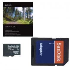
Garmin TOPO U.S. 24K West Brand New Includes One Year Warranty Product # 010-11314-00 (DVD) Product # 010-C0949-00 (microSD™/SD™card) The Garmin TOPO U.S. 24K - West navigational software covers topographic detail of Washington, Oregon, California and Nevada. Routable trails, rural roads, city neighborhood roads, major highways and interstates are shown in great detail. TOPO maps include points of interests such as parks, campgrounds, scenic lookouts and picnic sites. TOPO U.S. 24K - West Features: Navigational Software Compatible with Macintosh & Windows Detailed Topographic Maps of Washington, Oregon, California & Nevada (DVD-ROM) Detailed Topographic Maps of California & Nevada (microSD/SD Card) Hydrographic Features of Coastlines, Lake & River Shorelines, Wetlands, & Perennial/Seasonal Streams Routable Trails, Rural Roads, City Neighborhood Roads, Major Highways & Interstates Digital Topographic Maps -Based on the 1:24,000 Scale USGS Maps -Covering National, State & local parks, Forests & Conservation & Wilderness Areas as well as Bureaus of Land Management Township, Range & Section Information and USGS Quad Locations Searchable by City, Summit, Lakes, Campsites & More Amenities -Parks, Campgrounds, Scenic Lookouts & Picnic Sites Trip & Waypoint Management Function Elevation Profile(On Compatible Garmin Devices) Estimates Terrain Difficulty Click Here for Coverage Map *These Functions of this Product Work w/ Nearly all Garmin GPS Units, Excluding the GPS100 Family & Panel Mount Aviation Units.
